

Hafod-yr-ynys Roadside
Hafod-yr-ynys Roadside closed on 15/09/2023
You can still view any information available using the Site Information tab, or find data in the Data section.
For more information on this monitoring data please contact this local authority.
Hafod-yr-ynys Roadside closed on 15/09/2023
You can still view any information available using the Site Information tab, or find data in the Data section.
Statistics for Hafod-yr-ynys Roadside
| Site Name | Hafod-yr-ynys Roadside |
|---|---|
| Site Type | Kerbside |
| Easting, Northing | 321727, 198588 |
| Latitude, Longitude | 51.680579, -3.133508 |
| OS Grid Ref | ST217985 |
| Address | |
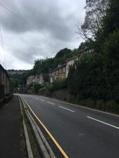
| Site Comments | This is a main road and gateway to Caerphilly CBC. This is a hill and on the opposite side of the road from Woodside Terrace is a large retaining wall which creates a canyon effect. There is a signalised junction at the bottom of the hill. All types of traffic use this road. |
| Monitoring Network: Welsh Automatic Urban pollution Monitoring | ||
|---|---|---|
| Parameter | Date Started | Date Ended |
| Nitrogen dioxide | 01/10/2011 | 15/09/2023 |
| Modelled Wind Direction | 01/10/2011 | 15/09/2023 |
| Nitrogen oxides as nitrogen dioxide | 01/10/2011 | 15/09/2023 |
| Modelled Temperature | 01/10/2011 | 15/09/2023 |
| Nitric Oxide | 01/10/2011 | 15/09/2023 |
| Modelled Wind Speed | 01/10/2011 | 15/09/2023 |
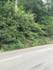
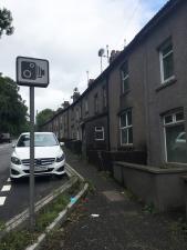
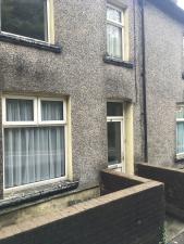
The photographs show the site itself, and views looking North, East, South and West.
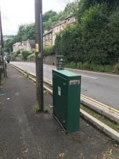
Monitoring Site Photo
View North
View East
View South
View West
Click the button below to create the PDF statistics report for the chosen year and site above. Please note that it is stated within the report text itself whether data used to create the statistical report is ratified or provisional.
Note: it may take a few seconds to generate the report.